


Courter Theater ‘Brings Hollywood’ to Gallatin, MO
Gallatin’s Courter Theater opened in 1920, operated by John E. Courter at 103 South Main Street.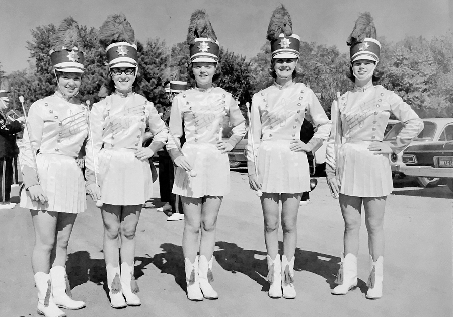
Yesteryear Music, Festivals in Gallatin’s Community Life
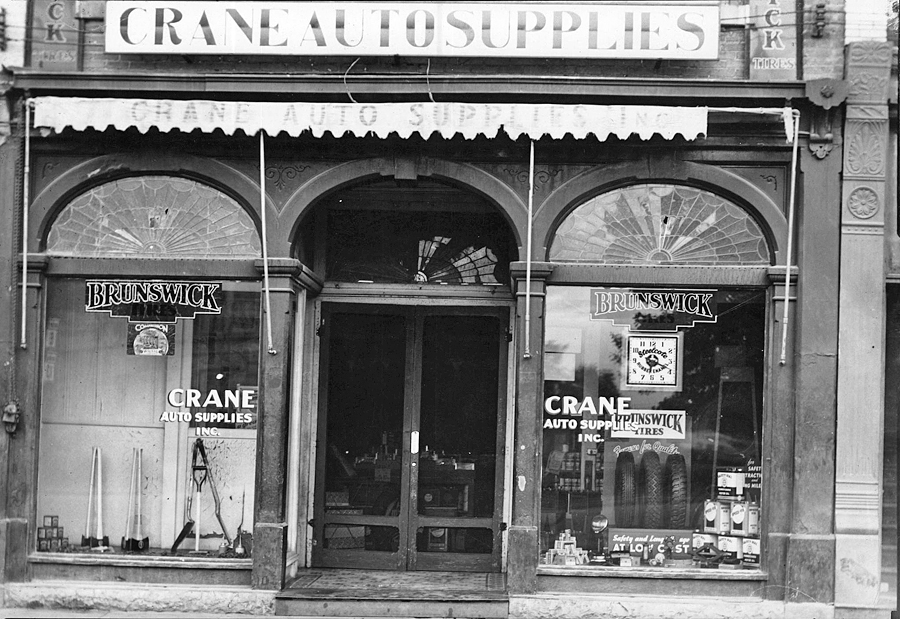
Crane Auto Supply a Brunswick Tire Dealer
Crane Auto Supply offered Brunswick Tires for sale as well as other vehicle products in Gallatin, MO.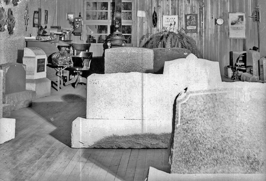
Gravestone Monuments Once Produced in Gallatin, MO
Stone monuments were once produced and sold from a storage building located just east of Hope Funeral Home at 106 West Van Buren Street in Gallatin, MO (date unknown)
Odd Fellows Building Anchors NW Corner of Square
The Odd Fellows Building was a prominent landmark at the northwest corner of the Gallatin, MO, business square for many years.
Newspapers: Altamont Index
This advertisement for the Altamont Index identifies F. H Hess as owner.
1900-1920: Poosey Community
This unusual map shows the rural Poosey community (1900-1920) located just east of Daviess County, MO, in an area spanning portions of Grundy and Livingston Counties. This map was prepared by Noel Davidson and drawn by Noel Roger Davidson II in July of 1987, from maps...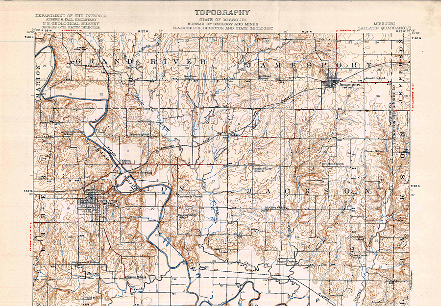
1920 Topography Map: Daviess County, MO
This 1920 topography map of Daviess County, MO, is stamped by the Department of the Interior, U.S. Geological Survey and Missouri’s Bureau of Geology and Mines....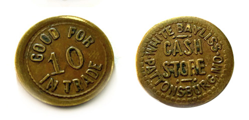
Brass Token From a Pattonsburg Grocery Store, But Little More Known
This brass token was once used to promote a grocery store in Pattonsburg, MO. It is just a little bit bigger than a penny. According to the internet research, trade tokens were used a lot all over the country in the 1800’s and early 1900’s. Todd Williams...
1920: Courter Theater Opens for Business, Lives Long
After being dormant for over half a year, Courter Theater in Gallatin initiated a new series of live performances in February of 1984. A country music group, “Blaze of Glory,” performed admission free — but a free will offering was requested to help...
1919: ‘Uncle Wes’ Robertson Shot, Becomes a ‘Newspaper Martyr’
Few events in history shook Gallatin, MO, more than when Hugh Y. Tarwater entered the office of The Gallatin Democrat on a chilly December afternoon in 1919 and fatally shot its longtime publisher, Wesley Robertson. History reveals “Uncle Wes” as the only...
A Newspaper Martyr: ‘Uncle Wes’ Robertson
Gallatin newspaper publisher Wesley L. “Uncle Wes” Robertson is known as Missouri’s Newspaper Martyr. In the building still housing printing presses off the northeast corner of Gallatin’s business square, Uncle Wes was fatally shot at his desk...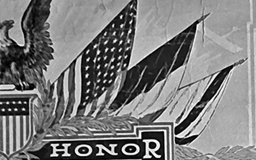
1919: Ornate Service Records for War Veterans
Upon honorary discharge, some soldiers returning from World War I were issued an ornate service record showing various scenes of military training and experiences:
World War I: Gallatin’s Flagpole Dedication at Courthouse
In 1918 America was at war and many Daviess County boys were overseas fighting for our nation’s freedom. On the home front, it was near the years of many bank failures and the many dry harvest years of the Great Depression. During this time of strife, a few...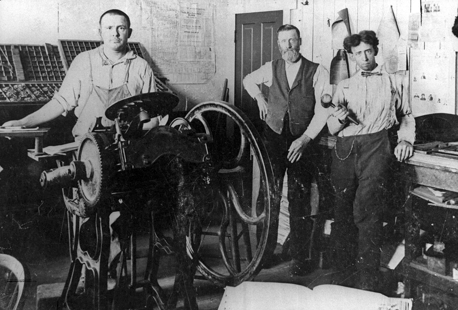
Newspapers: 4 Publications Once Served Winston, MO
Four newspapers served Winston, MO, during the years between 1880 to World War I. These included the Winston New Era, the Winston Independent, the Winston Star, and the Winston Sentinel....
Gallatin’s Connection to 2nd Worst Fatality Railroad Wreck in American History (1918)
July, 1918, marked the 100 year memorial of the second worst train wreck in United States history, and John Whitfield and Pam Parton of Gallatin, MO, attended a get together for survivors of the victims. They were joined by John’s two nephews, John J. Whitfield...
1918: An Historical Account of Grand River College
Grand River College was a co-educational institution, and is said to be the first college in Missouri to admit women on equal terms with men. It opened to the public in 1850 at Edinburg, Mo., and maintained there for 40 years. But because Edinburgh was an inland town,...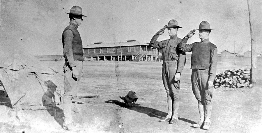
World War I: Daviess Countians Who Served
Listed below are the names of Daviess County boys were killed in action, died of wounds or sickness in France and in camps, or were injured in the service of our country during World War I. The following is a list of names of Daviess County boys were killed in action,...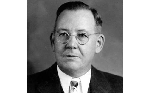
1917: Hope Funeral Home Begins Serving Generations
Harry Hope and wife Lenna moved to Gallatin in 1917 and acquired an interest in the L.T. Killam & Co. Undertaking business and changed the name to the Gallatin Undertaking Company (G.U.C.). The Hope Funeral Home was born. At first it was a two-fold business with...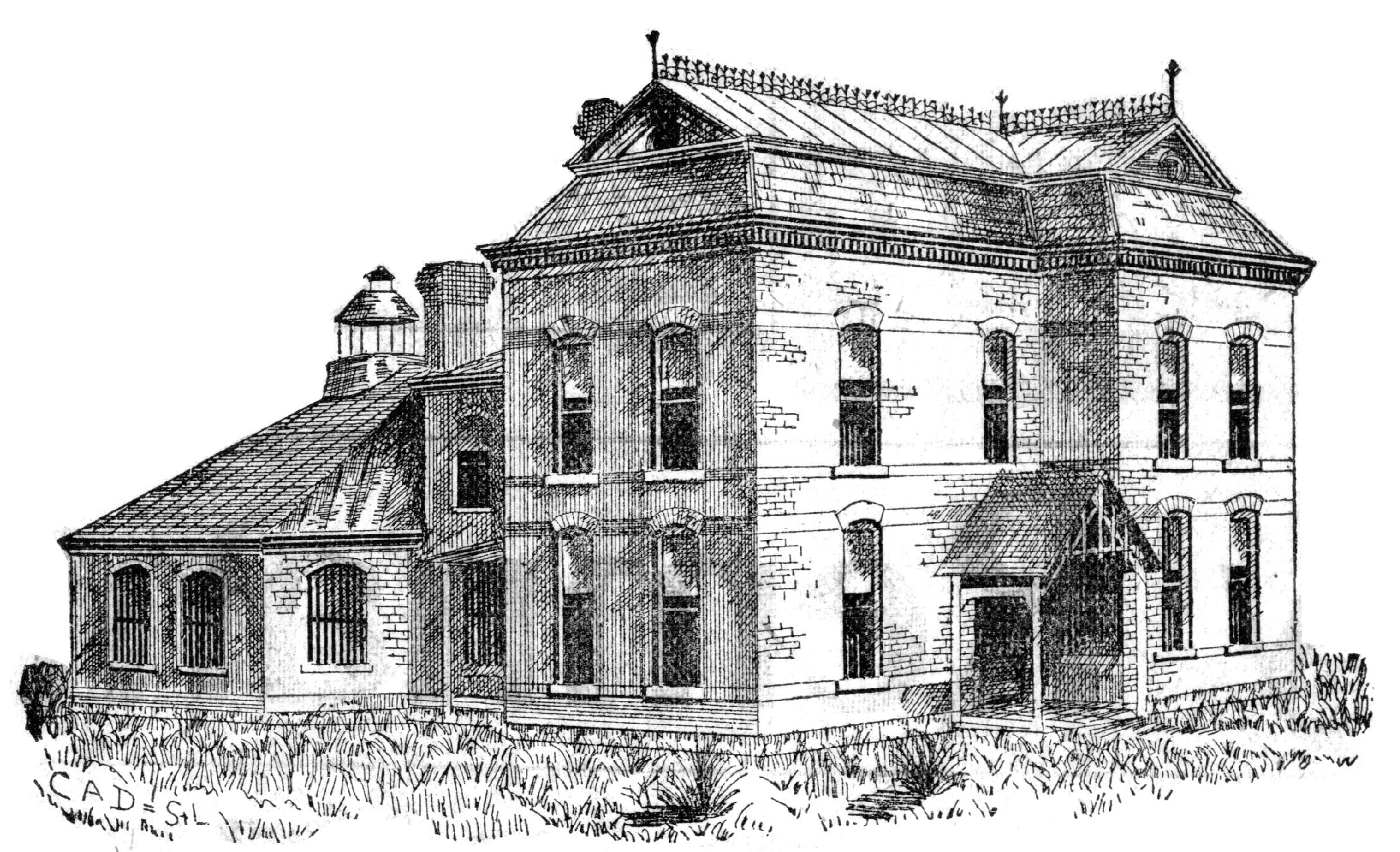
Visit the 1889 Squirrel Cage Jail, located 2 blocks west of the Daviess County Courthouse in Gallatin, MO. This historic relic is listed on the National Register of Historic Places and serves as a visitors’ center — by appointment,
Trudi Burton, ph: 660.663.7342
Search digital posts from 1999 to 2021:
GallatinNorthMissourian.com
Read the last special edition published by the Gallatin North Missourian in 2021:
Daviess County History Guide