This 1920 topography map of Daviess County, MO, is stamped by the Department of the Interior, U.S. Geological Survey and Missouri’s Bureau of Geology and Mines.
This website brought to you in part by the following sponsor:

Find out how to advertise here - Email us! [email protected]
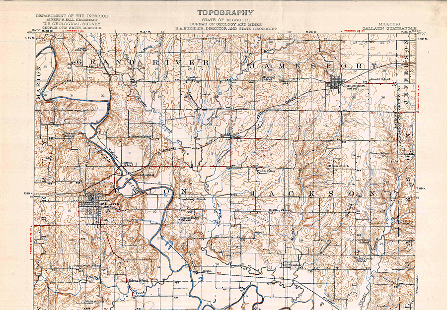
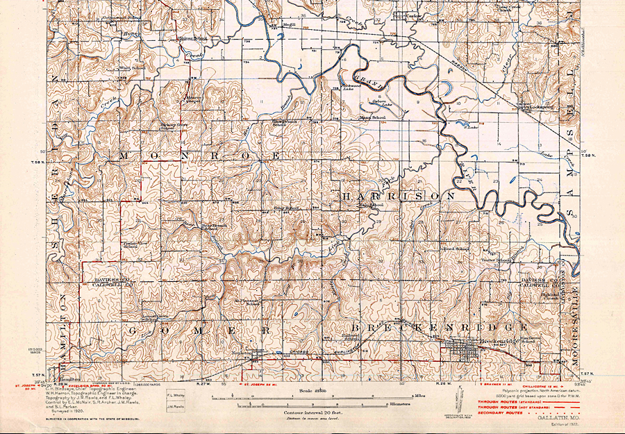
This 1920 topography map of Daviess County, MO, is stamped by the Department of the Interior, U.S. Geological Survey and Missouri’s Bureau of Geology and Mines.