

1898: Plat Map of Jameson, MO
1898 Plat Map of Jameson, MO
1898: Plat Map of Daviess County, MO
1898 Plat Map of Daviess County, MO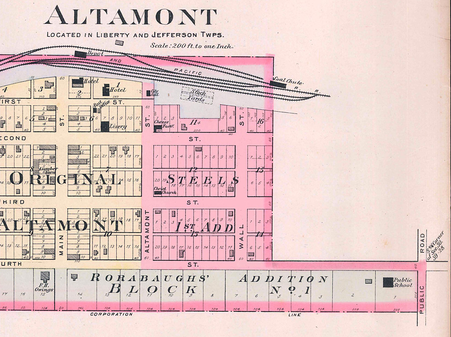
1898: Plat Map of Altamont, MO
1898 Plat Map of Altamont, MO
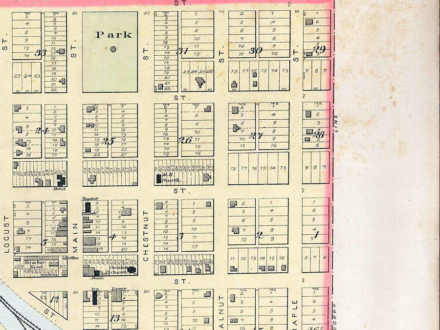
1898 Plat Map: Gallatin in Union Township, Daviess County, MO
This 1898 plat map of Gallatin, MO was prepared by Sanborn-Perris Map Company of New York. Fire protection included one hand engine and one hose cart worked by 12 volunteers. The map scale is 50 feet to an...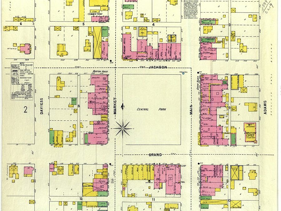
1898 Platt Map of Gallatin, MO
This 1898 map of Gallatin, MO was prepared by Sanborn-Perris Map Company of New York. Fire protection included one hand engine and one hose cart worked by 12 volunteers. The map scale is 50 feet to an...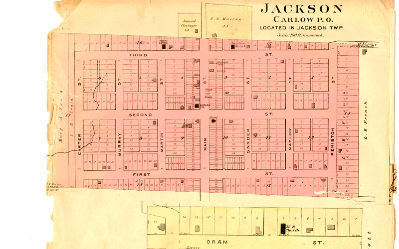
1898 Plat Map: Carlow in Jackson Twp., Daviess County, MO
This 1898 plat map shows Carlow in Daviess County, MO. Carlow is located in the southeast portion of the county in Jackson Township.
1898 Plat Map: Lock Springs, Jackson Twp., Daviess County, MO
This 1898 plat map of Lock Springs was published in the 1898 Plat Book of Daviess County, MO
Railroads: QO&KC Links Pattonsburg, Coffeyburg, Gilman City
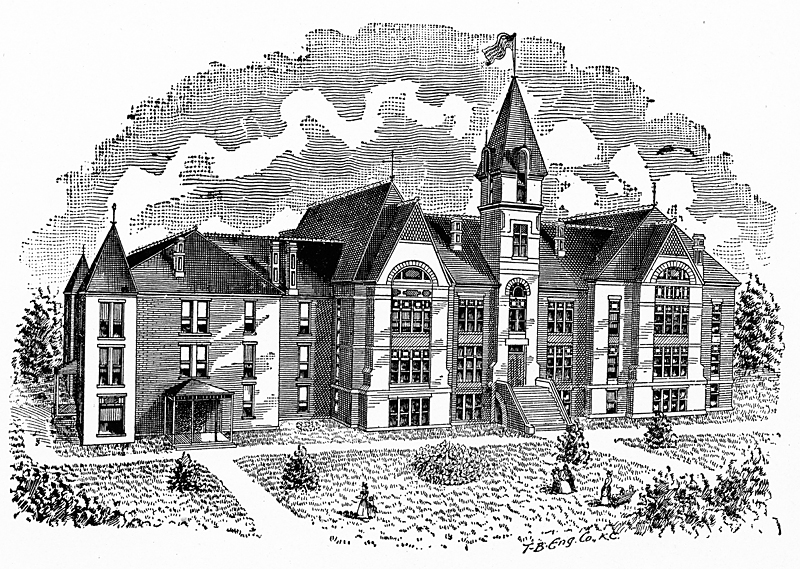
1893: Grand River College at Gallatin, MO
Grand River College was organized and opened to the public in 1850. It was located at Edinburg, Missouri, in Grundy County. It was named Grand River College Association, and was under the direction of the Baptists of Grundy and adjoining counties. After it had...
Groves Hotel at Wabash Crossing; City Hotel on Gallatin Square
Business cards provide evidence of hotels operating in Gallatin, MO, during yesteryear.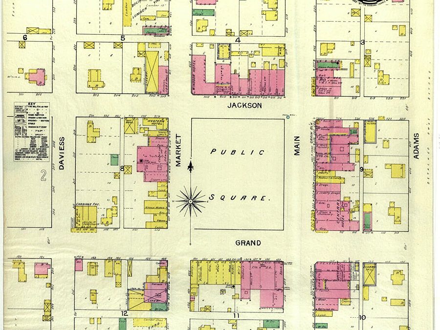
1893 Plat Map of Gallatin, MO
This 1893 plat map shows Gallatin, MO, population 1,800. The map, drawn to the scale of 50 feet to an inch, is stamped by Sanborn-Perris Map Co., Limited of New York.
Pioneer Navigates Daviess County’s Early History: Theodore Peniston
Theodore “Uncle Theo” Peniston is due the honor of being the first to utilize the Grand River as a highway for commerce. And before his death in 1892, Peniston passed through two Indian wars, the Mormon War, the Mexican War, the Civil War, and all the...
Gallatin’s Judge James H.B. McFerran Succumbs in Colorado
A letter to the editor submitted to a Colorado Springs, Colorado, newspaper offers a glimpse at the personality of James H.B. McFerran, once a leading citizen of Gallatin, MO, active in Democrat politics and organizer of a Union militia unit from Daviess County, MO,...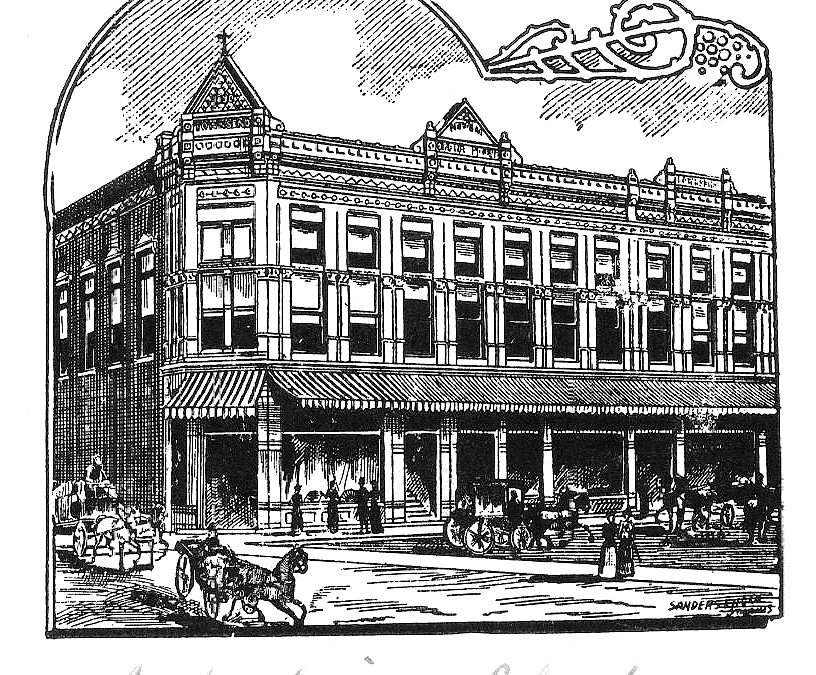
Arbelia Opera House of Gallatin, MO
In a 2-story building situated on the southeast corner of the Gallatin business square, the Arbelia Opera House once operated on the second floor above a saloon on the first floor. It was so named for the wife of John Townsend, who built the building about 1890. A...
Pioneers: Apple Orchard Records Reveal Early Ag Prices
In the early years of Daviess County, MO, many orchards were developed. This is a detailed record of one orchard once located a mile west of Civil Bend. Learning about it offers some understanding of local ag history. The records were kept by Edward Smith from 1890...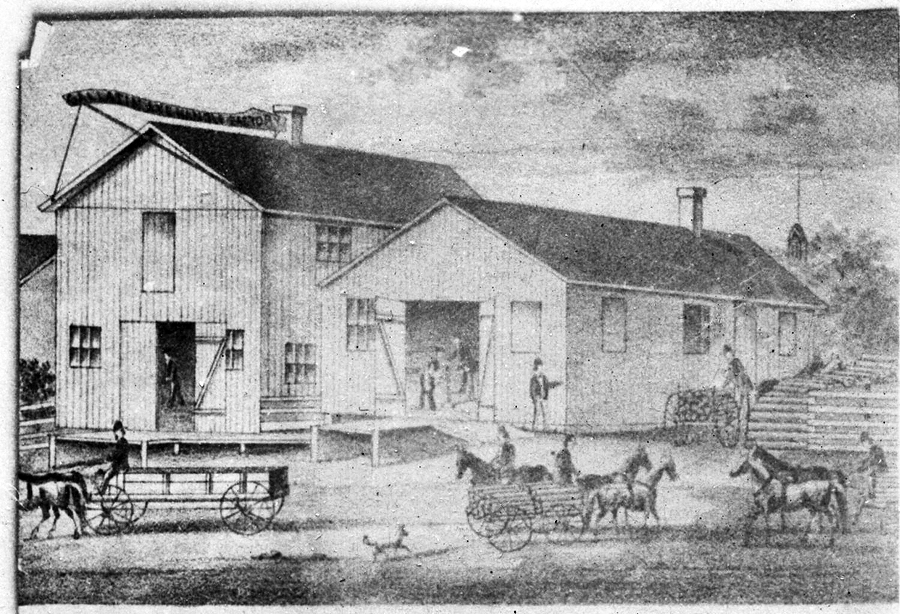
Snyder & Co. Axe Handle Factory of Gallatin, MO
This artist’s sketch depicts the John Snyder & Co. Axe Handle Factory of Gallatin, MO. (date unknown).
1890: Altamont Makes Its Place in Daviess County, MO
Altamont was laid out circa 1890. The town was so named on account of its lofty elevation, located on MO-6 about three miles northeast of Winston, MO, with Gallatin about six miles northeast. The Altamont Post Office has been in operation since 1890. Altamont’s...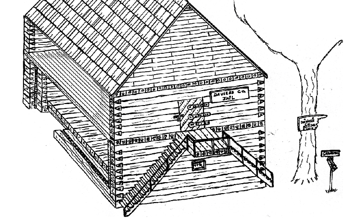
One of the First Public Buildings in Gallatin Was the ‘Pit Jail’
While most attention that can be mustered on jails focuses on the oddity of the 1889 Squirrel Cage Jail in Gallatin, some point to this jail’s predecessor with equal interest. David Stark, researching records at the county clerk’s office, offers the...
Rotary Jail Construction Cost $11,261.15
Research of Daviess County courthouse records (1885-1888) reveals much about the actions to develop the then new “squirrel cage” jail of 1888. This rotary-styled jail would replace the old stone jail located in the northwest corner of the public square in...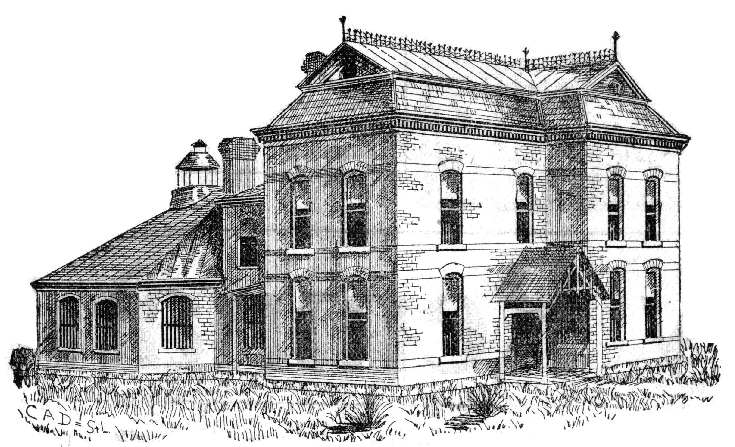
Visit the 1889 Squirrel Cage Jail, located 2 blocks west of the Daviess County Courthouse in Gallatin, MO. This historic relic is listed on the National Register of Historic Places and serves as a visitors’ center — by appointment,
Trudi Burton, ph: 660.663.7342
Search digital posts from 1999 to 2021:
GallatinNorthMissourian.com
Read the last special edition published by the Gallatin North Missourian in 2021:
Daviess County History Guide