
The relocation of the town of Pattonsburg, MO, to higher ground means news of Grand River flooding is less dramatic. None-the-less, flooding still impacts lives in Daviess County, MO, and the potential for serious damages and expense to those living and working near the river is real.
This website brought to you in part by the following sponsor:

Find out how to advertise here - Email us! [email protected]
Storms Thursday night, June 29, and continued rain Friday, June 30, 2017, saturated the ground in Northwest Missouri. Rivers and streams ran full and with nowhere else to go, the accumulating water collected on fields, drowning crops and closing highways.
Area farmers watched their soybean and corn fields slowly succumb to the rising water.
Larry Vaughn, a farmer at Pattonsburg, drove past Old Pattonsburg and as far south as Hwy. 69 would take him before the highway disappeared under a lake of blue. This was on Friday, June 30, around 10:30 a.m.
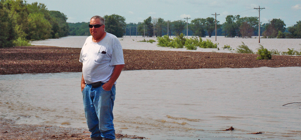
Larry Vaugh surveys the Grand River flooding off Highway 69 near Old Pattonsburg, MO, in 2017.
No flood in recent memory has matched the devastating flood of 1993 which prompted the whole town of Pattonsburg to move uphill. But there have been other years when the Grand overflowed its banks. Historic crests for the Grand River at Pattonsburg are as follows:
-
-
- Aug. 9, 1909 — 40 ft.
- July 24, 1993 — 36.60 ft.
- May 8, 2007 — 34.27 ft.
- June 1, 1947 — 34.25 ft.
- Sept. 14, 1973 — 33.80 ft.
-
Mr. Vaughn looked out over the fluid fields, not sure whether this flood matched the one in 2007. “If it’s not the most water, then it doesn’t miss it by much,” he said.
Mr. Vaughn owns 40 acres and rents 160 more. The land lies along the edges of the flood. He has soybeans on the right of Hwy. 69 and corn on the left. The soybeans are all under. The corn might not all be ruined, but he couldn’t get close enough at the time to tell. “You know every spring this can happen,” he said. “But you hope it won’t.”
Mr. Vaughn said he was by no means the farmer to have the biggest crop loss due to the floods.
Vanessa Templeton was visiting her grandmother Deb Snider, who lives in rural Pattonsburg, over the holiday weekend.
“This is crazy,” Vanessa said of the floodwaters. She and her grandmother had gone sightseeing the day before (June 29) and there was some flooding, but nothing to match what had taken place by Friday as the rains continued to fall Thursday night and the river continued to rise. Vanessa lives in Alma, MO. She visits her grandmother frequently.
“Today the park in Old Pattonsburg is underwater and Highway Z is underwater — it’s unbelievable,” she said.

Vanessa Templeton looks out over water flooding Route Z and the old town site of Pattonsburg, MO (town site before the 1993 Grand River flood).
Waters had not much receded by Saturday, though the day itself was dry with no added rain.
Daviess County Sheriff’s Deputy Larry Adams, who was off-duty at the time, helped a stranded motorist get off the Grand River Bridge, located a couple of miles west of Lock Springs on Saturday afternoon, June 1. The lady was from Nebraska and was apparently following her GPS, which indicated she should she keep going along Unity Avenue to reach her destination of Hamilton. The flooded road might have indicated otherwise.
According to Deputy Adams, the lady made it as far as the bridge, which, fortunately, was not underwater. She crossed the bridge, and when the gravel road made a steeper grade downward, knew she wouldn’t make it, turned around and stopped on the bridge.
“She was driving a Ford Escape SUV and the water reached the top of her wheel well,” said Deputy Adams, who said he could feel the currents in his own SUV as the road curved back toward the bridge. “She’s very lucky she stayed on the road and didn’t go off in the fields; it would have been a different situation.”
“I appreciate the Luke Perkins family and Beau Wells for their assistance towing her back to Lock Springs,” said Deputy Adams. “I could have gotten her out in my SUV, but her vehicle would have been there until the water receded.”
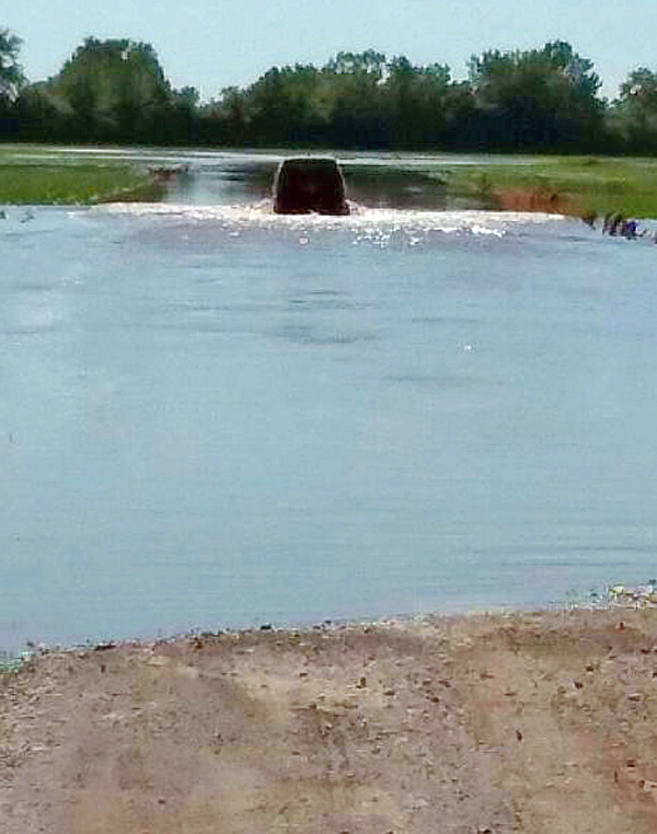
Daviess County Deputy Larry Adams drives his SUV through Lock Springs flood waters in 2017 to rescue Nebraska lady stuck on the Grand River bridge.
According to the National Weather Service, the thunderstorms on June 28 produced widespread heavy rainfall amounts. Two to five inches were noted generally north of Highway 36 with some localized amounts exceeding 10 inches from Maryville eastward to Bethany.

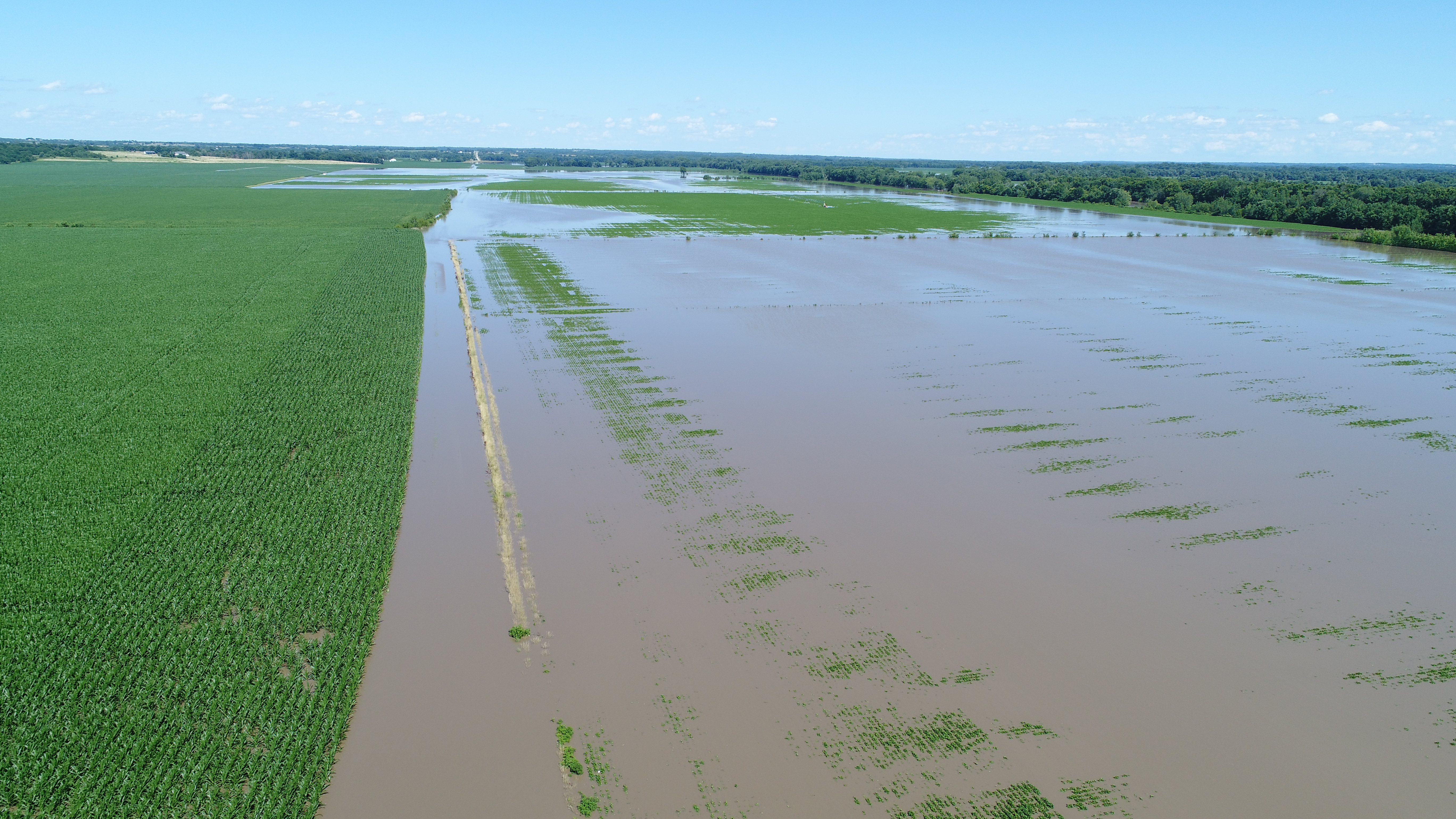
2017 Flood: Grand River looking north from Muddy Creek in Daviess County, MO.

Flooding which occurred in 2017 in streams throughout Daviess County, MO, may not rival the great floods of 1909 or 1993 on the Grand River but flood damage is a continual concern …and expense.

Flooding which occurred in 2017 in streams throughout Daviess County, MO, may not rival the great floods of 1909 or 1993 on the Grand River but flood damage is a continual concern …and expense. Larry Belshe is pictured at the hole in the road on Saber Road. He farms the Tuggle property between the Old and New Grand River bottoms.
2017 Flood: The submerged road to Landmark Manufacturing, east of the Muddy Creek Bridge.
2017 Flood: Flooding waters of the Grand River, east from Muddy Creek in Daviess County, MO.

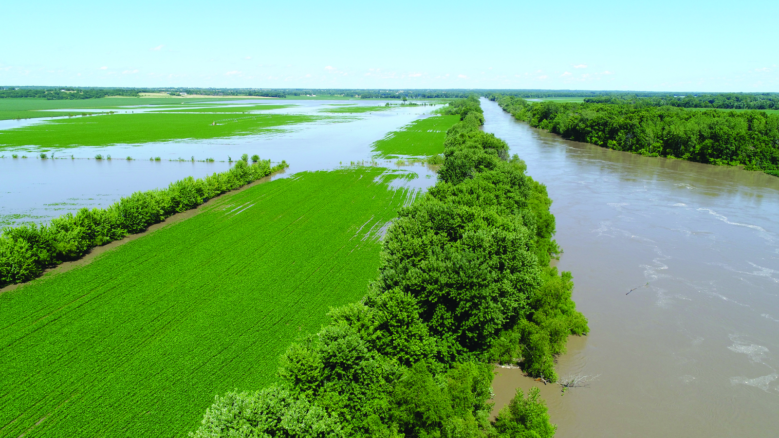
Grand River west of McGill Bridge, flooding the farmland owned by Rick Tolen (house 2nd to right)

Soybeans were covered by flooding waters of the Grand River. In some instances, corn standing at shoulder height and beginning to tassel was completely submerged.